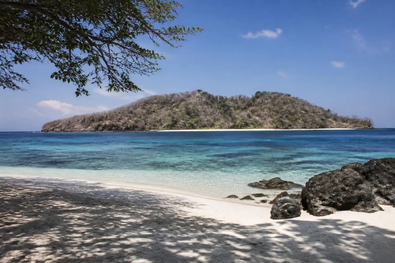
Half an Island at the End of the Archipelago
Timor-Leste is the country people find by accident on a map. It is the eastern half of an island at the far end of the Indonesian chain, about 700 kilometres northwest of Darwin, and the whole place covers less ground than Wales. It became a country in 2002, joined ASEAN as its eleventh member in October 2025, and still receives so few leisure travellers that on most days you will have the reef, the mountain and the road to yourself.
What it gives you is an unusual combination packed into a small space: some of the richest coral ever surveyed, a spine of mountains close to 3,000 metres high, Portuguese hill towns, a sacred island nobody sleeps on, and a capital that tells its own recent history without softening it. What it asks in return is patience. Roads are slow, hotels are simple, and flight connections are thin. This guide covers how the country fits together, when to go, how entry works now, and what the real risks are, from the team that runs our eight-day expedition from Dili to the eastern tip.
How the Country Fits Together
Dili sits on the north coast, on a long, calm bay facing Atauro Island, about 25 kilometres offshore. Behind the city the land climbs fast. A mountain spine runs the length of the country and peaks at Tatamailau, better known as Mount Ramelau, 2,986 metres. The south coast beyond it is wetter, greener and visited by almost nobody. In the far east, Lautem district flattens into dry savannah and limestone, and the road ends at Tutuala, on a cliff above the channel to Jaco Island. There is also an exclave, Oecusse, on the Indonesian side of the island, which very few itineraries include.
Distance is not the issue here. Time is. Dili to Maubisse in the coffee hills is only about 70 kilometres and takes close to three hours. Dili to Baucau is a little over 120 kilometres along the coast and takes about three. Baucau to Tutuala is another three, the last stretch on rough track. Plan on 30 to 40 kilometres an hour as an average, and you will rarely be disappointed.
Dili: Start With the Recent Past
Most people want to get out of Dili quickly. We think that is a mistake, because nothing else in the country makes sense without a morning spent on its history. Portugal held Timor for roughly four centuries. Indonesia invaded in December 1975 and stayed for twenty-four years, and the truth commission that followed (known by its Portuguese name, Chega!, meaning "enough") estimated that up to 183,000 people died as a result of the occupation. On 12 November 1991, Indonesian troops opened fire on mourners at the Santa Cruz cemetery, and footage smuggled out by a British cameraman put the territory on television around the world. On 30 August 1999, 78.5 percent of voters chose independence in a UN-run referendum, and militias burned much of the country in response. Full independence came on 20 May 2002.
You see that story in three places. The Chega! exhibition occupies the old Balide prison, where the cells have been left as they were. The Resistance Museum lays out the occupation year by year. The Santa Cruz cemetery is still a working cemetery, and you visit it quietly. Then climb the steps at Cape Fatucama to Cristo Rei, a 27-metre statue facing the city, for sunset, and finish with grilled fish on the beach road. Stop at the Tais Market for the hand-woven cloth the country is known for. It is the best souvenir in Timor and the money goes to the weavers.
Atauro and the Water
Atauro is the reason many divers have heard of Timor-Leste at all. A 2016 survey led by Conservation International recorded an average of 253 reef-fish species per site around the island, the highest average figure found anywhere. The island sits between the Ombai and Wetar straits, where the seabed falls to thousands of metres close to shore, so the reef wall often starts a short swim from the sand.
The crossing from Dili takes about ninety minutes by fast boat and regularly turns up spinner dolphins. From roughly October into December, the same deep channel carries migrating whales, including pygmy blue whales, close enough to the coast to be seen from a boat. On the island, the lodges at Beloi and around the coast are simple, solar-powered and right on the water. You do not need to dive. The shallows are excellent with a mask and snorkel, and the walk inland to the villages of Adara and Vila, where weaving and fishing still run daily life, is half the point of staying two nights.
The Mountains: Maubisse and Ramelau
Drive south from Dili and within an hour you are in cloud. Maubisse, at about 1,400 metres, is coffee country: smallholder arabica grown under shade trees the Portuguese planted, still the country's largest export after oil and gas. The Timor Hybrid, a natural cross found on the island in the last century and now in the family tree of coffee varieties planted around the world, was first identified here. Walk the gardens with a grower and drink the coffee where it is picked. Nights are cold enough for a fleece, which surprises everyone.
Ramelau is the climb worth getting up for. You leave Maubisse around 3 a.m., drive to Hatubuilico, and walk about two hours on a good path to the summit and its statue of the Virgin. On a clear dry-season dawn you see the sea on both sides of the island at once. It is a steady walk rather than a technical one, but the altitude and the dark make it feel harder than it is, so bring a headlamp and decent shoes.
The East: Baucau, Tutuala and Jaco Island
Baucau, the second city, is the most handsome town in the country: a Portuguese old town on a hillside, an arcaded market building and a spring-fed pool below. The beaches below it at Osolata and Watabo are white, clear and usually empty. Further east around Lospalos you start to see the Fataluku houses, raised on stilts under tall, steep roofs, a style found nowhere else in the country.
The road ends in Nino Konis Santana National Park, the country's first. Above Tutuala, the Ili Kere Kere rock shelter holds painted boats, figures and hand stencils, and Timor was a stepping stone on some of the earliest human sea crossings toward Australia. From Valu Beach a fisherman takes you the 200 metres across to Jaco Island. It is sacred to the Fataluku and uninhabited, and nobody is allowed to stay the night. You get a kilometre of white sand and two shades of water for the day, and then the boat comes back for you.
When to Go
The dry season runs from May to October, and that is when we run the trip. June to August is the sweet spot: cooler in the mountains, clear dawns on Ramelau and calm water for the Atauro crossing. September and October are hotter on the coast but bring the start of the whale passage through the straits. From November to April the rains come. Landslides close mountain roads, the track to Tutuala turns to mud and boats are cancelled. Some lodges stay open, but we do not sell the full route in the wet season because we cannot promise it will run.
Visas, Flights and Money
Most nationalities, including US, Canadian, Australian and British passport holders, get a visa on arrival at Dili airport: 30 days, $30 USD, paid in cash. Citizens of most Schengen countries can enter visa-free for up to 90 days. You need six months of passport validity. If you are thinking of crossing overland from Indonesian West Timor at Batugade, arrange the paperwork in advance rather than assuming the border will issue a visa. Entry formalities have changed more than once in recent years, so we send each guest the current procedure, including any online forms, before travel.
Getting there means connecting. Bali to Dili is the main route, with daily flights of under two hours. Darwin to Dili suits anyone coming through Australia, and there are direct services from Kuala Lumpur. Other routes come and go, so check before you build plans around one. Because the regional legs are few and small, we ask guests to arrive the day before the expedition starts.
The currency is the US dollar, with locally minted centavo coins for small change. Bring clean, recent notes in small denominations. ATMs exist in Dili and almost nowhere else, and cards are accepted in a handful of hotels and restaurants in the capital. Outside it, assume cash.
Safety and Health: A Straight Answer
The US State Department rates Timor-Leste Level 2, exercise increased caution, in its May 2026 advisory, citing petty crime and occasional unrest. That matches our experience. In Dili, bag snatching and theft from vehicles happen, demonstrations occasionally meet tear gas, and youth gang fights sometimes flare in particular neighbourhoods. You avoid crowds, keep phones out of reach of passing scooters and do not wander at night. Outside the capital, the hospitality is warm and the crime risk is low.
The bigger risks are the ordinary ones. Roads are narrow, mountain bends are blind, and landslides are common in the wet. We do not drive after dark. On the health side, there is good news: the World Health Organization certified Timor-Leste malaria-free in July 2025. Dengue is still present, so repellent matters, and a travel clinic will usually suggest hepatitis A and typhoid cover. Medical care is basic. Anything serious is evacuated to Darwin or Bali, so insurance with medical evacuation is not optional. Atauro and the far east have no hospital, which is one reason our leaders carry a satellite messenger and a proper first-aid kit.
What an Expedition Costs and How It Runs
Our Timor-Leste expedition runs eight days from $3,795 USD per person: two nights in Dili, two on Atauro, one at Maubisse, two in Baucau, with the long day to Tutuala and Jaco in between. That covers a private 4WD and driver throughout, an English-speaking Timorese leader for the whole trip, local guides on Atauro, Ramelau and at Tutuala, the boat crossings, snorkelling gear and the Ramelau ascent. International flights, the $30 visa, insurance, some meals and tips are extra.
Be clear-eyed about the beds. There is no five-star stock in Timor-Leste. The hotels are comfortable and characterful: a seafront property in Dili, an eco-lodge on Atauro, an old Portuguese pousada in the hills. What you are paying for is the planning, the timing of boats and dawns, and a leader who lived through the history you are hearing about.
You can travel independently, and some people do. But the Atauro ferry schedule changes without notice, public minibuses east of Baucau are infrequent and keep no fixed timetable, and getting to Jaco and back in a day without a driver is close to impossible. If you want to see the whole country in a week and a bit, a private trip is the efficient way to do it. Send us your dates by WhatsApp or email, and we will come back with how the dry season falls for you.
Ready to Start Planning?