A Country With No Lowlands
Lesotho is the only country on Earth that sits entirely above 1,000 metres. Its lowest point, where the Makhaleng River joins the Senqu on the southern border, is about 1,400 metres above sea level. That is the bottom. Everything else climbs from there, up through sandstone valleys and basalt ridges to Thabana Ntlenyana at 3,482 metres, the highest summit in southern Africa.
It is a small kingdom, about the size of Belgium, and it is wrapped on every side by South Africa. Most people who know the name know it from a road sign on the way to the Drakensberg or a stamp they picked up driving the Sani Pass for an afternoon. Very few stay. That is a pity, because the interior is one of the most striking mountain landscapes on the continent: herders in heavy wool blankets on sure-footed ponies, villages of stone and thatch, and a road network built almost entirely out of passes.
This guide covers the circuit we run: Sani Top and the escarpment, the dams at Katse and Mohale, Semonkong and the Maletsunyane Falls, and the pony country around Malealea. It also covers the practical side, from seasons and border crossings to money and a plain answer on safety.
How the Highlands Fit Together
Think of Lesotho as a high plateau tilted to the west. The lowlands, which are only low by local standards, run in a strip along the western border, and that is where Maseru, the airport and most of the population sit. East of them the Maloti range rises in a series of ridges, and beyond those is the roof of the country, a treeless highland that ends abruptly at the Drakensberg escarpment above KwaZulu-Natal.
You do not travel across this country so much as over it. The roads are a sequence of passes: Moteng and Mahlasela in the north, the Mafika-Lisiu above Katse, and the A3 east of Maseru, which crosses Bushman's Pass, the Blue Mountain Pass and a hairpin climb called Molimo Nthuse, roughly "God help me". Most of the main circuit is now good tar. The exceptions are the ones worth driving: the gravel road through Linakaneng between Mokhotlong and Katse, and the final switchbacks of the Sani Pass. Distances look short on a map and take twice as long as you think. Eighty kilometres of gravel can fill a morning.
Sani Top and the Escarpment
Sani Top is the reason most people have heard of Lesotho, and it earns the reputation. The pass climbs out of the Mkhomazana valley in South Africa through a set of tight hairpins and tops out at 2,874 metres, right on the lip of the escarpment. The South African approach has been tarred in stages over the past decade, but the steepest section below the top is still a rough 4x4 track, and conditions change with every storm. Whichever side you come from, drive it in daylight.
The South African border post sits at the bottom of the hairpins and the Lesotho post at the top, with a few kilometres of no man's land in between. Both keep daytime hours only, so time your crossing around them and check the current times before you set off.
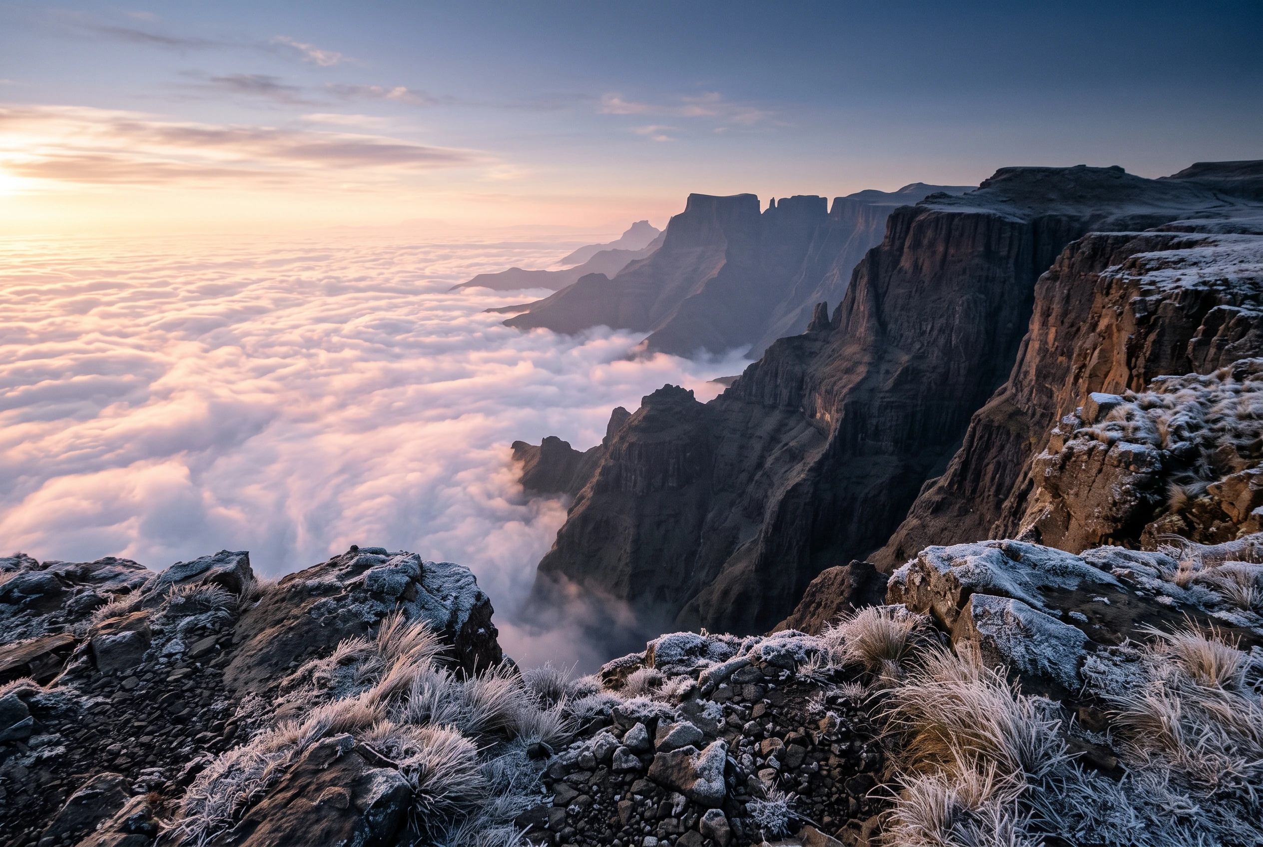
Stay the night rather than turning round. On the rim you can walk north toward Thabana Ntlenyana, which is a long day out and back for fit walkers, or simply follow the edge for a few hours with the whole Drakensberg wall falling away below you. In the evening the lodge pub at the top, which has sold itself for years as the highest pub in Africa, fills with drivers and walkers comparing notes on the road. At dawn the valleys below are often full of cloud, and you stand above it.
Katse, Mohale and the Water
Lesotho's most important export is water. The Lesotho Highlands Water Project dams the rivers of the highlands and sends the water by tunnel to Gauteng, and it pays a large share of the national budget. You see it best at Katse, a double-curvature arch dam 185 metres high that holds back the Malibamatso in a long, branching reservoir. The approach from Mokhotlong through Linakaneng ends with the water appearing below you without warning, deep blue against bare brown hills.
The dam tour takes you inside the wall itself, which is worth doing for the scale alone, and the botanical garden next to it holds plants rescued from the valleys that were flooded. Up the Mafika-Lisiu Pass, the Bokong Nature Reserve sits at just over 3,000 metres, with a short walk to the Lepaqoa waterfall, which freezes solid in a hard winter. Further south, Mohale is the rockfill sibling of Katse, quieter and every bit as photogenic. A second phase of the project is building a new dam at Polihali, near Mokhotlong, so expect construction traffic on that side of the country for the next few years.
Semonkong and the Maletsunyane Falls
Semonkong means "place of smoke", after the spray that hangs over the Maletsunyane Falls. The river drops 192 metres in a single fall into a sheer basalt gorge, one of the highest single-drop waterfalls in southern Africa, and from the lip you look straight down the full height of it. Go in the morning, when the light is behind you and the spray column is at its tallest. After good summer rain the volume is huge. In a dry winter it can thin to a ribbon, and in a very cold spell it freezes at the edges.
Semonkong itself is a trading town at about 2,275 metres where horses still outnumber cars on a market day. The lodge here runs a commercial abseil beside the falls, 204 metres on a single rope, which has long been listed as the longest commercially operated single-drop abseil in the world. It is optional and costs extra. Everyone else walks or rides down to the pool at the bottom, which is a fine half day in its own right.
Malealea, Ponies and Thaba-Bosiu
In much of the highlands the Basotho pony is still the vehicle rather than the attraction. At Malealea, a lodge and village in the Makhaleng valley, you can ride the working animals with the men who own them, at a walk, down into a gorge with San rock paintings and no road. The ponies are bred for this terrain and are steadier on loose rock than most larger horses. No riding experience is assumed, and there is a walking route through the same valley.
Before or after, give half a day to Thaba-Bosiu, the flat-topped mountain outside Maseru where Moshoeshoe I settled his people in 1824. It was never taken, and the kingdom exists largely because of that. A village guide walks you up the old defended pass to the graves of the early kings. South of Malealea, Morija has the oldest museum in the country and dinosaur trackways in the sandstone above the mission. Look out along the way for the conical mokorotlo hat, the national symbol on the flag, and the patterned wool blankets every herder wears, which are less a costume than the most practical clothing in the country.
When to Go
Altitude beats latitude here. Lesotho has summer rain and winter cold, and both are more extreme than you would guess from a map of southern Africa.
Summer, November to March, is green and warm by day, with heavy afternoon thunderstorms that can flood river crossings and turn gravel roads to slurry. Winter, June to August, is dry, clear and very cold: nights at Sani Top fall well below freezing, snow can close the high passes for days at a time, and the small ski area at Afriski, near the Mahlasela Pass, runs its season. The shoulder months are the sweet spot. March to May brings stable weather and golden grass after the rains, and September to November brings clear days, cold nights and the first green. Those are the windows we run in.
Whatever the month, pack a proper insulated jacket, a warm hat and gloves. Snow has fallen on the high passes in every month of the year.
Entry, Flights and Money
Citizens of the US, the UK, the EU and many Commonwealth countries can enter visa free. The US State Department notes that American citizens are given a 30-day stay on arrival, with a passport valid for at least six months. Almost everyone reaches Lesotho through South Africa, so you also need to meet South African entry rules, including two blank visa pages in your passport, and you will collect a fresh set of stamps every time you cross. Check both sets of rules for your own nationality before you book.
There is a short daily flight from Johannesburg to Moshoeshoe I International, about 20 minutes south of Maseru. Many travellers prefer to fly into Johannesburg or Bloemfontein and drive to the border instead, using Maseru Bridge, Ficksburg or, with a 4x4, Sani Pass.
The currency is the loti (plural maloti), pegged one to one with the South African rand. Rand are accepted everywhere in Lesotho, but maloti are not accepted in South Africa, so ask for change in rand where you can. ATMs work in Maseru and the larger towns. In the highlands, carry cash.
Safety, Altitude and Health
The risks here are mostly mountain risks. The weather turns fast, a pass can close with an hour's warning, and on the gravel roads a breakdown is a long wait for help. Drive in daylight only, carry warm clothes and water in the vehicle, and give yourself slack in the schedule. We carry a satellite communicator because phone signal disappears on long stretches of the eastern highlands.
On crime, the honest picture is mixed. The US State Department rates Lesotho Level 2, "exercise increased caution", citing crime including armed robbery and carjacking, and police response can be slow. Most of that risk is concentrated in Maseru and the lowland towns, after dark. The highland villages are calm, and in our experience travellers are met with curiosity and good manners. Do not walk around Maseru at night, keep valuables out of sight in the car, and use lodges with secure parking.
Altitude catches people out because the country does not look like high mountains from the road. Most nights on our circuit are between 1,600 and 2,874 metres, so take the first two days easy and drink plenty of water. Anyone with heart or lung conditions should speak to their doctor first. There is no malaria in Lesotho. Medical care outside Maseru is basic, and serious cases go to South Africa, so travel insurance with evacuation cover is essential.
What an Expedition Costs and How It Runs
Our Lesotho expedition runs twelve days from $4,795 USD per person twin share, with a single supplement of $540. It is a clockwise loop from Maseru: north to Ts'ehlanyane and the Mahlasela Pass, east to two nights on the rim at Sani Top, across the Linakaneng road to Katse and Bokong, through the Blue Mountain Pass to Mohale, then south to Semonkong and Malealea and back by way of Morija. Transport is a private 4WD with a Mosotho driver-guide who drives these passes year round.
The lodges are comfortable and heated rather than grand, simple at Sani Top and Katse, and the price includes breakfasts, park fees, the Katse dam tour and the pony trek or valley walk. Lunches, dinners and the Semonkong abseil are extra.
You could drive much of this yourself in a hired 4x4 from South Africa, and some people do. Where it goes wrong is the joins: a pass closed by snow with no alternative booked, a border post that shut an hour before you arrived, a broken axle on the Linakaneng road. Send us your dates over WhatsApp or email, tell us how you feel about horses and cold mornings, and we will shape the route around you.
Ready to Start Planning?